Published on August 5, 2016

Much has been said about sidewalks as theaters of urban life. Productive democratic friction between strangers is one of the hallmarks of good city building, yet this vision of a grandly equitable platform for urban life is not without flaws. Sidewalks may appear to be benign slabs of concrete or brick, but as platforms for daily life they are inextricably bound to the politics of urban areas. In rapidly growing cities such as Seattle, these challenges can often come to the forefront.
Our conception of sidewalks is being expanded by the integration of a variety of transportation right of ways, parklets, as well as café and restaurant seating. As we seek to inject green spaces, bike corridors, and social business facades into confined spaces between buildings and streets the politicality of sidewalks becomes more legible.
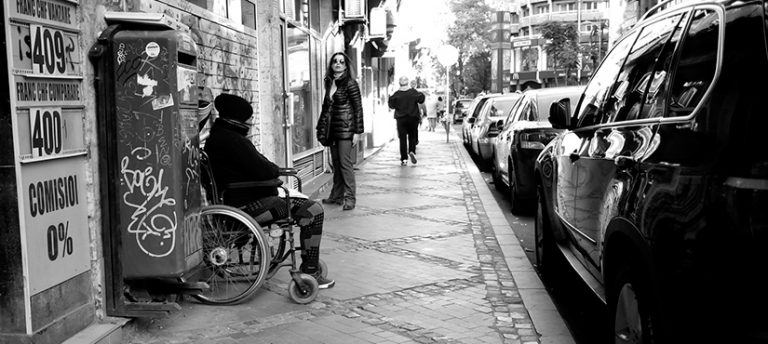
The spatial density of sidewalks isn’t just an issue of integrating various right of ways, there are also very real implications for personal mobility.
When faced with navigational questions most of us are quick to ask a passerby, or perhaps more likely now, to pull out a phone and open an app. However, this solution relies on having a cellphone and is woefully inadequate for people with limited mobility. Perhaps you’ve confronted the flaw in this reflex in your own adventures across town, or when helping a relative or friend with an assistive device, or even when riding your bike. Suddenly you find yourself having to pay very close attention to surface conditions and curb cut availability. Inadequate pedestrian and navigational infrastructure can be a nuisance to anyone, but for people with mobility limitations or low vision these conditions can not only be extremely frustrating, but hazardous.
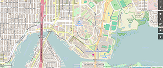
This Sunday the Taskar Center for Accessible Technology and the OpenSidewalks team, from the UW eScience Institute’s Data Science for Social Good program are hosting a map-a-thon to start to addressing these issues. Maps and data collected by Seattle community members will be integrated the open source, OpenStreetMap platform in order to enable more robust sidewalk information, and navigational assistance for those with limited mobility. The map-a-thon will be held:
Sunday, August 7th
12-4pm
Paul G. Allen Center for Computer Science and Engineering
Room 305 (CSE 305)

The event does not require people to have any experience in data collection, GIS, or coding. OpenSidewalks and Taskar representatives will guide you through some quick tutorials, and you are encouraged to bring your phone, a laptop and mouse if you have one, but there is ample opportunity for field mapping, using an old-fashioned pen and paper as well. Not to mention there’s free pizza and refreshments AND this is child friendly event.
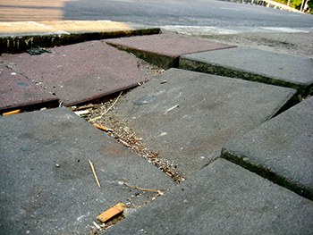
This sort of civic engagement with our public space is essential, particularly in a city like Seattle. Our combination of wet winters, along with a mix of soft sandy soils and heavy glacial till can lead to sidewalks heaving and becoming uneven over time. Bike lanes have been used as parking zones, and seemingly ubiquitous construction often results in sidewalk closures or revisions that are not always easily navigable.
In light of the city’s ongoing development there has been frustration and concern as to who has priority in these pubic right of ways, and who is being affected. Sidewalk closures and rerouting present challenges to any pedestrian, and these issues are amplified for people with low vision and mobility restrictions. Seattle Weekly quoted Jacob Struiksma, a blind resident of the Roosevelt neighborhood, about the numerous challenges, delays, and general unpredictability created by widespread construction projects.
The integrity of sidewalks is not only a matter of temporary inconvenience, the Weekly also indicated it can curb people’s transportation preferences, shrinking walking range to what is explicitly known and immediate. Closures and alterations are necessary aspects of developing cities and this complex relationship highlights one of the reasons collaborations like that of the OpenSidewalks project, King County Metro, and the broader community are so important.

Those in poorer neighborhoods often face sustained complications in regards to pedestrian infrastructure. Governing magazine covered this issue in depth in 2014, finding that poorer areas have approximately double the pedestrian fatality rates of wealthier areas. This problem is created by a perfect storm of structural inequality patterns where more disenfranchised areas of a city often have: poorly maintained infrastructure, less transportation options, and are frequently either bounded or divided by major roads or highways. Further compounding these infrastructural conditions, residents in such neighborhoods are often the ones who depend most on walking and public transportation. The lingering effects of disinvestment and redlining unfortunately manifest in mobility issues for minority or disenfranchised communities. The Washington Post interviewed Kate Lowe, assistant professor at the University of Illinois at Chicago, about her study of New Orleans sidewalks. Lowe looked at the continuity of sidewalks between bus stops in neighborhoods and found that areas with low poverty rates, particularly white communities, were most likely to have continuous sidewalks. Those with high poverty rates were most likely to have intermittent sidewalk coverage.
Correlations between SAT scores or college acceptance rates and zip codes demonstrated strong correlations between citizen well-being and location, and as it turns out even the conditions of our sidewalks can be found to indicate inequities across urban space.
The need for both better information about access and pedestrian mobility is necessary as we attempt to transition from a completely car-centric culture to a city embracing multi-modal, equitable transportation systems. But cognizance of sidewalks’ importance for mobility across different communities may unfortunately remain an issue and illustrates that urban environmental justice concerns even seemingly benign sidewalks.
Written by Andrew Prindle, Urban@UW Communications Coordinator