Published on June 5, 2024
Written by Natalia Mesa for High Country News
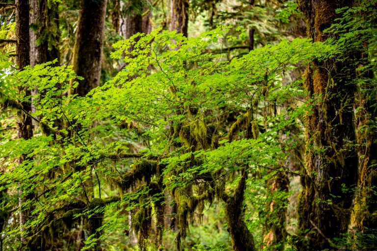
On a warm day in August, Anthony Stewart hiked through a forest on Washington’s Olympic Peninsula, making his way through a tangle of ferns and grasses. Wispy, lichen-coated branches hung overhead, providing shade as he set down his backpack and shovel, and he and his team prepared to dig.
This was one of Stewart’s favorite study sites, he said. It’s relatively dry on the surface, but just underneath it, a layer of reddish soil, full of organic matter, gives way to gray-blue, claylike soil. These layers, formed over time as water flooded the area, are signs of a wetland. But like many forested wetlands in the Pacific Northwest, this area doesn’t appear on any state maps.
In a recent study published in Nature Communications, Stewart and his team reported the surprising abundance of unmapped, carbon-rich wetlands in the Pacific Northwest’s forests. The scientists studied the Hoh River watershed, which snakes westward across the Olympic Peninsula, documenting wetlands that were invisible to satellite imaging, the standard technique for measuring wetlands, owing to the thick forest canopy. Including them in estimates of the watershed’s carbon-storage capacity increased them by fivefold.
Conserving forested wetlands not only protects valuable habitat; it could help stabilize the climate. But first, the wetlands must be put on the map — and that is no easy task.
WETLAND ECOSYSTEMS are stunningly effective at soaking up carbon from the atmosphere. Despite covering only roughly 6 to 8% of the world’s land surface, they contain roughly 20 to 30% of the carbon stored in the soil. And because the plant matter in the waterlogged soil decays slowly, their carbon tends to stay put.
Wetlands provide other benefits, too: More than 10% of all species, including 50% of all endangered ones, rely on wetlands. The gnarled roots of wetland trees and plants purify water, and the wetland soils absorb it, providing flood protection to nearby areas.
Since the 1920s, the Department of Agriculture has surveyed the types and quality of soil throughout the nation. But until recently, these soil maps focused primarily on agricultural land, leaving out most forests and leaving huge gaps in knowledge about the Pacific Northwest and Alaska. On top of that, “wetlands were not at all a focus in forested landscapes,” said David D’Amore, a soil scientist with the USDA Forest Service and a co-author of the study.
Continue reading here.
Anthony Stewart, a doctoral student in environmental and forest sciences at the University of Washington , discusses unmapped carbon-rich wetlands int he Pacific Northwest.