Published on October 6, 2020

As the city of Seattle shut down in March 2020 to try to slow the spread of COVID-19, a group of University of Washington researchers got to work.
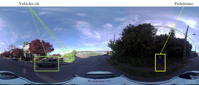
The team developed a project that scans the streets every few weeks to document what’s happening around the city — answering questions such as: Are people outside? Are restaurants open? This project, which began in May and will continue until at least fall of 2021, collects images of how Seattle has reacted to the pandemic and what recovery looks like. This creates a massive dataset that documents what was happening at any particular point in time. The researchers hope the data will help answer questions about what makes a city resilient and how to better prepare for potential future pandemics and other disasters.
“We talk about resilience a lot in disaster sciences. There are lots of theories about what makes a community resilient to natural hazards, but we don’t fully understand resilience to pandemics, partially because we just haven’t been through these events at this scale,” said co-lead researcher Nicole Errett, an assistant professor of environmental and occupational health sciences. “This project provided us with an opportunity to see what’s important for resilience in this context. What are people doing? Where are they recreating? Are they following distancing and mask-wearing recommendations? And how do their activities change as the pandemic progresses?”
To track what’s happening in Seattle, the researchers drive a car with a camera similar to Google Street View on top throughout the city.
Joseph Wartman, a professor of civil and environmental engineering; Scott Miles, a senior principal research scientist in human centered design and engineering; Youngjun Choe, an assistant professor of industrial and systems engineering; Jaqueline Peltier, an operations specialist in civil and environmental engineering; Matthew Martell, a doctoral student in industrial and systems engineering; Christopher Salazar, a master’s student in industrial and systems engineering; and Vanessa Yang, an undergraduate student in statistics and informatics, are also part of this project.
Continue reading at UW News.
Originally written by Sarah McQuate for UW News.