Urban Research Tools
A curated selection of tools within the broad categories of equity, data, or mapping to assist with urban research projects. Click on the categories below to view the lists of tools.
Equity Data Mapping
Equity
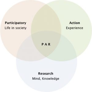 Community Based Participatory Research Toolbox
Curriculum, publications, webinars and other resources to assist with researchers and organizations that are interested in, or about to commence, Community Based Participatory Research (CBPR).
 Data Walks: An Innovative Way to Share Data with Communities
A Data Walk focuses on data sharing as the platform for collaboration. Several objectives: to share key data and findings with community residents and program participants; to ensure a more robust analysis and understanding of the data; to help inform better programming and policies to address both the strengths and the needs of a particular community or population; and to inspire individual and collective action among communities.
Allows for users to look at the wealth profile of their respondents in comparison to the whole country, or in comparison to urban areas only. People in urban areas are often relatively wealthy compared to the rest of the country. National wealth quintiles are a way to evenly divide the national population into categories of wealth; however, if respondents are all in urban areas, they are likely to be among the wealthiest in the nation. Looking at their relative wealth in comparison to other urban dwellers may provide more insight.
 Handbook on Measuring Equity in Education
Provides practical guidance on the calculation and interpretation of indicators designed to target the most disadvantaged groups. It is intended for anyone involved in the measurement and monitoring of equity in education, especially those concerned with national policymaking. It addresses the current knowledge gaps and provides a conceptual framework to measure equity in learning.
The vision of the Seattle Race and Social Justice Initiative is to eliminate racial inequity in the community. To do this requires ending individual racism, institutional racism and structural racism. The Racial Equity Toolkit lays out a process and a set of questions to guide the development, implementation and evaluation of policies, initiatives, programs, and budget issues to address the impacts on racial equity.
Data
Allows for users to look at the wealth profile of their respondents in comparison to the whole country, or in comparison to urban areas only. People in urban areas are often relatively wealthy compared to the rest of the country. National wealth quintiles are a way to evenly divide the national population into categories of wealth; however, if respondents are all in urban areas, they are likely to be among the wealthiest in the nation. Looking at their relative wealth in comparison to other urban dwellers may provide more insight.
The Eviction Lab at Princeton University has built the first nationwide database of evictions. Find out how many evictions happen in your community. Create custom maps, charts, and reports. Share facts with your neighbors and elected officials.
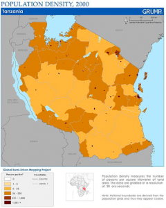 Global Rural-Urban Mapping Project: Data Sets + Map Gallery + Hazards Mapper
Improved data on patterns of human settlement and trends in population can help researchers and policy makers better understand differences between urban and rural areas in terms of their impacts on the environment and vulnerability to environmental variability and change. This data collection is a valuable resource both for researchers studying human-environment interactions and for applied users working to address critical environmental and societal issues.
Enables users to examine urban forest resources at all scales, from entire states and municipalities to neighborhoods, lots, and individual trees. i-Tree increases understanding of urban forest resources and helps inform green infrastructure management and planning. Specifically designed to meet the needs of all communities, it can be used by state forestry agencies, cities, stewardship groups, residents, students, and anyone else interested in learning more about and caring for their local forest resources.
 Metabolism of Cities
Data from a variety of research studies that have calculated particular values (material extraction, emissions, construction material use, imports, exports, etc.) for an urban/provincial region. The metabolism indicators will also take into account energy, water, air pollution as well as urban characteristics indicators.
Free and open access to data about countries and cities around the globe. The urban indicators data available here are analyzed, compiled and published by UN-Habitat’s Global Urban Observatory which supports governments, local authorities and civil society organizations to develop urban indicators, data and statistics.
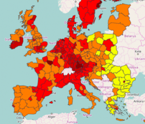
Joint initiative of the Joint Research Centre (JRC) and the Directorate General for Regional and Urban Policy (DG REGIO) of the European Commission. It aims at providing access to information on the status and trends of European cities and regions, as well as to the exploration of EU-supported integrated urban and territorial development strategies.
UWDC Provides the infrastructure to harness innovative, hard-to-access data for the development of novel, high-quality research and evidence-driven policy making. A key objective of the UWDC is to foster collaborative relationships between UW researchers and community partners, including government organizations, non-profits, and other service providers, interested in better utilizing their data for cross-cutting research, program evaluation, and policy development.
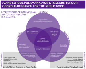 UW Evans School Policy Analysis and Research Group (EPAR)
Links to research resources and software tools used by EPAR, a research and analysis group that helps inform investment strategies aimed at alleviating some of the world’s most complex and pressing economic, agricultural, public health, and environmental challenges.
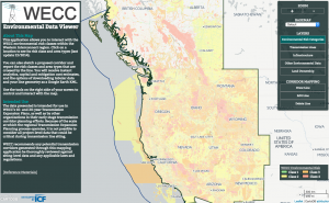 WECC Environmental Data Viewer
The Western Electricity Coordinating Council maintains a massive electric system across the Western Interconnection, a geographic area including parts of Canada, the western US, and northern Mexico. The WECC Environmental Data Viewer is an interactive data visualization of the area built with open data, providing access to environmental and cultural risk classification across the Western Connection to facilitate regional expansion projects across city, state, regional, and national borders.
Mapping
Azavea uses the power of technology to improve communities and the planet. Using geospatial technology, they enable their clients to answer complex questions in a wide range of domains: urban ecosystems, water, infrastructure planning, economic development, public transit, elections, public safety, energy, and cultural resources management.
A 12-week fellowship where geospatial data analysis students work alongside experienced mentors to complete projects for nonprofit organizations.
The Eviction Lab at Princeton University has built the first nationwide database of evictions. Find out how many evictions happen in your community. Create custom maps, charts, and reports. Share facts with your neighbors and elected officials.
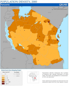 Global Rural-Urban Mapping Project: Data Sets + Map Gallery + Hazards Mapper
Improved data on patterns of human settlement and trends in population can help researchers and policy makers better understand differences between urban and rural areas in terms of their impacts on the environment and vulnerability to environmental variability and change. This data collection is a valuable resource both for researchers studying human-environment interactions and for applied users working to address critical environmental and societal issues.
Joint initiative of the Joint Research Centre (JRC) and the Directorate General for Regional and Urban Policy (DG REGIO) of the European Commission. It aims at providing access to information on the status and trends of European cities and regions, as well as to the exploration of EU-supported integrated urban and territorial development strategies.
 WECC Environmental Data Viewer
The Western Electricity Coordinating Council maintains a massive electric system across the Western Interconnection, a geographic area including parts of Canada, the western US, and northern Mexico. The WECC Environmental Data Viewer is an interactive data visualization of the area built with open data, providing access to environmental and cultural risk classification across the Western Connection to facilitate regional expansion projects across city, state, regional, and national borders.
 Equity Tool for Urban Surveys
 Seattle Racial Equity Toolkit
 Eviction Lab
 i-Tree Software Suite
 UN-Habitat Urban Data
 Urban Data Platform
 UW Data Collaborative (UWDC)
 Azavea